Inside Weather Radar: From Raindrop Echoes to Storm Motion Maps
Every sweep of a radar dome quietly traces the outline of storms we cannot see with our eyes. By sending out brief bursts of energy and listening for tiny echoes from raindrops, hail, and even swirling winds, these systems turn invisible structure in the air into practical maps that support everyday and emergency decisions.
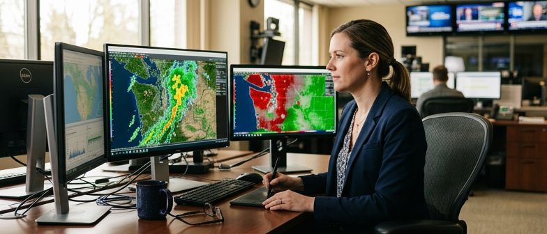
This story is part of DailySeekers's practical reading library across everyday topics.
From Pulses To Pictures: What The Antenna Is Really Doing
A modern weather unit sends out short bursts of microwave energy, then goes quiet. During that quiet gap, it listens for tiny echoes that bounce back from raindrops, snowflakes, or hail.
Those pulses travel at the speed of light. By measuring how long it takes for each echo to return, the system estimates distance: a fast echo means a nearby target, a slower one means it is farther away. The direction is set by where the antenna was pointing when that pulse went out, so each little echo can be mapped to a specific spot in space.
By repeating this process while the antenna sweeps around, the system fills in a circular picture of targets, turning simple “blips” into a structured view of nearby weather.
Strength and motion in the same signal
The returning signal is very weak, so it needs careful processing. One part focuses on strength, often called reflectivity. Stronger echoes usually come from heavier rain or larger particles, while lighter echoes might mean drizzle or thin snow.
Another part looks at changes in frequency between what was sent and what came back. This shift, known from Doppler principles, reveals motion toward or away from the device. From that, the system estimates radial velocity, which helps separate moving weather from more stationary clutter such as terrain or buildings.
Layering reflectivity and velocity together turns pulses and echoes into colored radar images that show where precipitation is located, how intense it is, and how it is moving.
How raw signals become a map
Once strength and motion are estimated, software groups the results into small blocks, often shown as pixels on a map. Each block gets a color based on how strong the echo is or how fast the air is moving along the beam.
Filters then try to remove non‑weather targets, such as tall structures or other clutter. The end product is a color‑coded picture that updates regularly, letting people see patterns rather than raw, noisy dots.
A simplified way to picture this processing is:
| Stage in system | What happens to the signal | What the user eventually sees |
|---|---|---|
| Pulse sent and echo received | Short burst goes out, faint echo returns from drops or ice | Raw timing and strength values |
| Processing and filtering | Distance, direction, and motion are derived and clutter reduced | Colored blocks arranged around the site, forming recognizable shapes |
| Display and interpretation | Different layers (strength, motion) combined or toggled | Maps of rain and wind that people use for planning and safety decisions |
Making Sense Of The Colors: Intensity, Motion, And Odd Patterns
Colorful radar images can look dramatic, but they follow consistent rules that make them easier to interpret.
Intensity maps: how hard it is coming down
Those familiar green–yellow–red blobs mainly show how hard it is raining or hailing. The system sends out pulses, measures what bounces back, and turns that signal strength into color on the map.
On most displays, green suggests light precipitation. As the signal gets stronger, colors move into yellow and orange, which usually indicates moderate rain. Deep red is a heads‑up for very heavy rain, strong storms, or even hail in some cases.
The color bar at the side of the map is the legend: cooler colors near the bottom, warmer colors toward the top.
Motion views: toward the site, away from the site
Some displays swap intensity colors for motion colors. These “velocity” views often use red–green or red–blue pairs.
On these views, one color shows air moving toward the radar, and the opposite color shows air moving away. When those colors sit right next to each other in a tight couplet, it can hint at rotation or sharp wind changes within a storm.
Not every strange pattern on a radar screen reflects real weather. Bullseye rings, perfect circles, or a blank “donut hole” around the radar site can appear because of the shape of the beam or the way the system is tuned.
To keep the different views straight:
| Display type | Main focus | Helpful in these situations |
|---|---|---|
| Reflectivity (intensity) | How strongly drops or ice send energy back | Checking where it is raining or snowing, spotting heavier cores |
| Velocity (motion) | Air or drops moving toward or away from the beam | Gauging wind patterns, seeing hints of rotation or sharp shear |
| Combined views | Overlay or side‑by‑side comparison | Matching heavy rain with strong winds to assess possible hazards |
Dancing Drops And Hidden Winds: From Rotation To Heavy Rain
Beyond simple blobs of color, radar can reveal how storms are organized and where the most intense parts might be hiding.
How the “dance” of raindrops reveals motion
The system sends bursts of energy into the sky and listens for the echoes from raindrops, snowflakes, or hail. Stronger echoes usually mean heavier precipitation, which is why the colors on a radar map deepen from light to dark as rain gets heavier.
Doppler techniques examine tiny changes in the returning signal to sense whether drops are moving toward or away from the radar along the beam. When different parts of a storm show different motion, the pattern starts to reveal how air is swirling inside the clouds.
Forecasters look for organized patterns. Broad areas of similar motion suggest a steady flow, while tight, contrasting patches of toward‑and‑away motion can point to more complex circulation.
Rotation, hail, and intense cores
Rotation shows up when one side of a storm has drops moving toward the site and the other side has drops moving away, in a compact area. That couplet hints at a spinning updraft, often called a mesocyclone. These rotating cores are closely linked with the potential for severe behavior, so they receive close attention in live feeds.
Hail leaves its own footprint. Because hailstones are bigger and more reflective than raindrops, they can create very strong echoes, sometimes forming a tight, bright area on the image. When that bright core lines up with strong updrafts and organized motion, concern about damage tends to increase.
Heavy rain is more straightforward. Broad swaths of strong echoes mark downpours. By watching how these areas move, merge, or weaken, radar helps indicate which regions are more likely to see sudden flooding, intense wind, or rapidly shifting storm conditions. It does not replace local reports on the ground, but it offers a wider view that can be updated frequently as storms evolve.
Limits, Blind Spots, And Smarter Use During Real Storms
Radar can feel very “all‑seeing”, but it has real limits that matter when making decisions at home or on the road.
Where the beam cannot see clearly
The beam travels in a straight line and gradually curves upward with distance. Far from the site, it may be sampling snow or rain high above the ground, while people underneath are still dry or already flooded. Mountains or tall terrain can block the beam and create wedges where almost nothing is seen.
Very close to the radar, coverage can be tricky as well. The beam needs some distance to “open up”, so tiny, shallow showers nearby may look weaker or patchy. Light drizzle, mist, or very small drops might not reflect enough energy to stand out from background noise.
Obstacles such as buildings or terrain can add clutter, especially at low levels. Processing steps try to remove these signals, but they are not perfect. Some patterns are technical artifacts rather than real storms.
Using radar as one tool among many
During intense storms, snapshots can be confusing if taken too literally. A solid block of color does not mean every street is getting the same rain. One pixel can cover a large area, and the system has to estimate how rainfall is distributed inside that pixel.
Heavy downpours can produce very strong echoes that look dramatic, even when they are brief or very localized. On the other hand, low‑level winds that cause sudden gusts or dust can stay below the lowest beam and barely appear at all. Melting snow, hail mixed with rain, or debris in strong winds can distort the picture.
For everyday use at home, it helps to treat radar as a moving trend rather than a perfect truth. Watching several frames in a row shows how fast storms are moving and whether echoes are building or fading near you. Matching that motion with what you see out the window and with trusted alerts or forecasts gives a more grounded sense of local risk.
If the map shows strong echoes but you hear no thunder and the ground is dry, you might be under a high beam or in a blocked sector. If echoes look weak but the rain outside is clearly heavy, the beam could be overshooting the most intense part of the cloud. Knowing these limits turns radar from just a colorful image into a more reliable guide for day‑to‑day choices.
Q&A
-
How do modern systems improve the accuracy of How Weather Radar Works compared with older radars?
Modern units use dual‑polarization pulses, scanning both horizontal and vertical dimensions to better distinguish raindrops, hail, snow, insects, and debris. Combined with higher scan frequencies, adaptive beam tilts, and advanced clutter filters, this greatly refines range, intensity, and motion estimates, producing more reliable real‑time storm structures for decision makers. -
What extra steps are involved in Rainfall Detection Basics when turning reflectivity into estimated rain rates?
Rainfall estimates rely on empirical Z‑R relationships that convert radar reflectivity into precipitation rate, often adjusted for drop size distributions and storm type. Algorithms blend multiple elevation angles, correct for beam overshoot and attenuation, and may assimilate gauge networks, yielding quantitative precipitation estimates that support flood forecasting and water‑resource planning. -
How is Storm Motion Mapping used operationally beyond just showing where storms are moving now?
Forecasters track centroid positions of high reflectivity and velocity signatures over time, then apply extrapolation plus steering‑flow winds from models. This supports short‑term “nowcasts,” probabilistic swath projections, and arrival‑time graphics that guide siren activations, air‑traffic routing, road closures, and event managers deciding whether to shelter or evacuate crowds. -
Why is understanding Radar Signal Reflection crucial for Severe Weather Monitoring and warnings?
Reflection characteristics hint at hydrometeor type, particle concentration, and sometimes debris presence. Extremely high reflectivity with specific dual‑pol signatures can suggest large hail, while irregular, chaotic returns may signal tornado debris. Integrating these cues with velocity couplets lets meteorologists upgrade advisories to severe thunderstorm or tornado warnings more confidently and earlier. -
How do Forecast Support Tools and Atmospheric Science Communication turn complex radar data into public‑friendly information?
Decision‑support platforms blend radar with lightning, satellites, and models, auto‑flagging threats like hail cores, mesocyclones, and training echo bands. Communicators then translate these outputs into clear maps, timelines, and impact‑based messages, avoiding jargon while explaining confidence and uncertainty so communities can act quickly without misunderstanding technical radar details.